Public Types | Public Member Functions | Static Public Member Functions | Public Attributes | List of all members
TGraphAntarctica Class Reference

#include <TGraphAntarctica.h>

Public Types

enum  { defaultGpsTreeStride = 10000 }
 

Public Member Functions

 TGraphAntarctica (Int_t n)
 
 TGraphAntarctica (Int_t n, const Int_t *x, const Int_t *y)
 
 TGraphAntarctica (Int_t n, const Float_t *x, const Float_t *y)
 
 TGraphAntarctica (Int_t n, const Double_t *x, const Double_t *y)
 
 TGraphAntarctica (const TGraph &gr)
 
 TGraphAntarctica (TChain *chain, TString lonSelector="longitude", TString latSelector="latitude", TCut cut="")
 
 TGraphAntarctica (TTree *tree, TString lonSelector="longitude", TString latSelector="latitude", TCut cut="")
 
 TGraphAntarctica (const TVectorF &vx, const TVectorF &vy)
 
 TGraphAntarctica (const TVectorD &vx, const TVectorD &vy)
 
 TGraphAntarctica (const TH1 *h)
 
 TGraphAntarctica (const TF1 *f, Option_t *option="")
 
 TGraphAntarctica (const char *filename, const char *format="%lg %lg", Option_t *option="")
 
 TGraphAntarctica (const BaseList::base &b)
 
 TGraphAntarctica (const BaseList::path &p, UInt_t interpTime=0)
 
virtual void SetPoint (Int_t i, Double_t lon, Double_t lat)
 
virtual void SetPoint (Int_t i, const AntarcticCoord &coord)
 
virtual void SetPointEastingNorthing (Int_t i, Double_t easting, Double_t northing)
 
Double_t * GetEasting ()
 
Double_t * GetNorthing ()
 
void Draw (Option_t *opt="")
 
void ExecuteEvent (Int_t event, Int_t x, Int_t y)
 
virtual TAxis * GetXaxis ()
 
virtual TAxis * GetYaxis ()
 
ClassDef(TGraphAntarctica, 1) private AntarcticaBackgroundgetBackground () const
 Don't persist.
 
void init ()
 
void convertArrays ()
 

Static Public Member Functions

static TGraphAntarcticamakeGpsGraph (int firstRun, int lastRun, int gpsTreeStride=defaultGpsTreeStride, bool quiet=true)
 

Public Attributes

Bool_t doneConversion
 
TString fToolTipExtraTextFormat
 

Detailed Description

Class to greatly simplify the task of drawing TGraphs on a background of Antarctica This class expects you to provide lon, lat as the X, Y inputs. Get it the right way round! It then talks behind the scenes to RampdemReader and converts those numbers to Easting/Northing The Draw option has been redefined to plot everything on a background of Antarctica.

Getting something approximating standard TGraph drawing behaviour was a massive pain... There's probably a few bugs in here still, but I'm happy enough with the current functionality.

Definition at line 35 of file TGraphAntarctica.h.

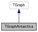
Inheritance diagram for TGraphAntarctica:
Inheritance graph
[legend]
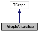
Collaboration diagram for TGraphAntarctica:
Collaboration graph
[legend]

Constructor & Destructor Documentation

TGraphAntarctica::TGraphAntarctica ( const BaseList::path p,
UInt_t  interpSeconds = 0 
)

Constructor for BaseList::path

Parameters
pis the const reference to the path
interpSecondsis a time to interpolate between point, if 0 the raw data is used and no interpolation is done (default=0)

Definition at line 150 of file TGraphAntarctica.cxx.

Member Function Documentation

void TGraphAntarctica::ExecuteEvent ( Int_t  event,
Int_t  x,
Int_t  y 
)

Interactive magic.

Parameters
eventis the user interaction
xis the x-coordinate of the pixel under the mouse
yis the y-coordinate of the pixel under the mouse

Definition at line 261 of file TGraphAntarctica.cxx.

TGraphAntarctica * TGraphAntarctica::makeGpsGraph ( int  firstRun,
int  lastRun,
int  gpsTreeStride = defaultGpsTreeStride,
bool  quiet = true 
)
static

Construct a TGraph antarctica from run firstRun to lastRun (inclusive) This is mostly for plotting purposes, otherwise

Parameters
firstRunis the first run
lastRunis the last run
pointEvery
quietdefault true
Returns
the newly constructed TGraphAntarctica

Definition at line 76 of file TGraphAntarctica.cxx.

void TGraphAntarctica::SetPoint ( Int_t  i,
Double_t  lon,
Double_t  lat 
)
virtual

Set the ith point of the Graph to a longitude/latitude Handles the conversion to easting/northing internally

Parameters
iis the graph point
lonis the longitude
latis the latitude

Definition at line 43 of file TGraphAntarctica.cxx.

void TGraphAntarctica::SetPoint ( Int_t  i,
const AntarcticCoord coord 
)
virtual

Set the ith point to the position held in the AntarcticCoord

Parameters
iis the point to set
coordis the position (is internally converted to WGS84)

Definition at line 57 of file TGraphAntarctica.cxx.

void TGraphAntarctica::SetPointEastingNorthing ( Int_t  i,
Double_t  easting,
Double_t  northing 
)
virtual

Don't do the conversion from lon/lat to easting/northing

Parameters
i
easting
northing

Definition at line 335 of file TGraphAntarctica.cxx.


The documentation for this class was generated from the following files: