#include <AntarcticaGeometry.h>
|
| enum | CoordType { WGS84,
STEREOGRAPHIC,
CARTESIAN
} |
| |
|
|
| AntarcticCoord (CoordType coord_type=CARTESIAN, double xval=0, double yval=0, double zval=0) |
| |
|
| AntarcticCoord (const TVector3 &v) |
| |
|
| AntarcticCoord (const Adu5Pat *pat) |
| |
|
TVector3 | v () const |
| |
|
void | set (CoordType coord_type, double xval, double yval, double zval) |
| |
|
const AntarcticCoord | as (CoordType new_type) const |
| |
|
void | to (CoordType new_type) |
| |
|
CoordType | currentType () const |
| |
|
void | asString (TString *str) const |
| |
|
|
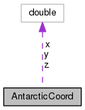
double | x |
| |
|
double | y |
| |
|
double | z |
| |
Some things to help divide up Antarctica Cosmin Deaconu cozzy.nosp@m.d@ki.nosp@m.cp.uc.nosp@m.hica.nosp@m.go.ed.nosp@m.u Slightly smarter Antarctic Coordinates.
Definition at line 19 of file AntarcticaGeometry.h.
computes the surface distance between two points (i.e. ignoring altitude)
Definition at line 985 of file AntarcticaGeometry.cxx.
The documentation for this class was generated from the following files:


 1.8.11